Fail:Bonny City - panoramio.jpg
Shi nwuana̱son huni:a̱yaapixel 800 × 533 Ngyong ghyáng: a̱yaapixel 320 × 213 | a̱yaapixel 640 × 427 | a̱yaapixel 1,024 × 683 | a̱yaapixel 1,280 × 853 | a̱yaapixel 2,560 × 1,707 | a̱yaapixel 6,000 × 4,000.
A̱tsatsak fail (A̱yaapixel 6,000 × 4,000, shi fail: 6.28 MB, kak MIME: image/jpeg)
Nam-a̱lyiat
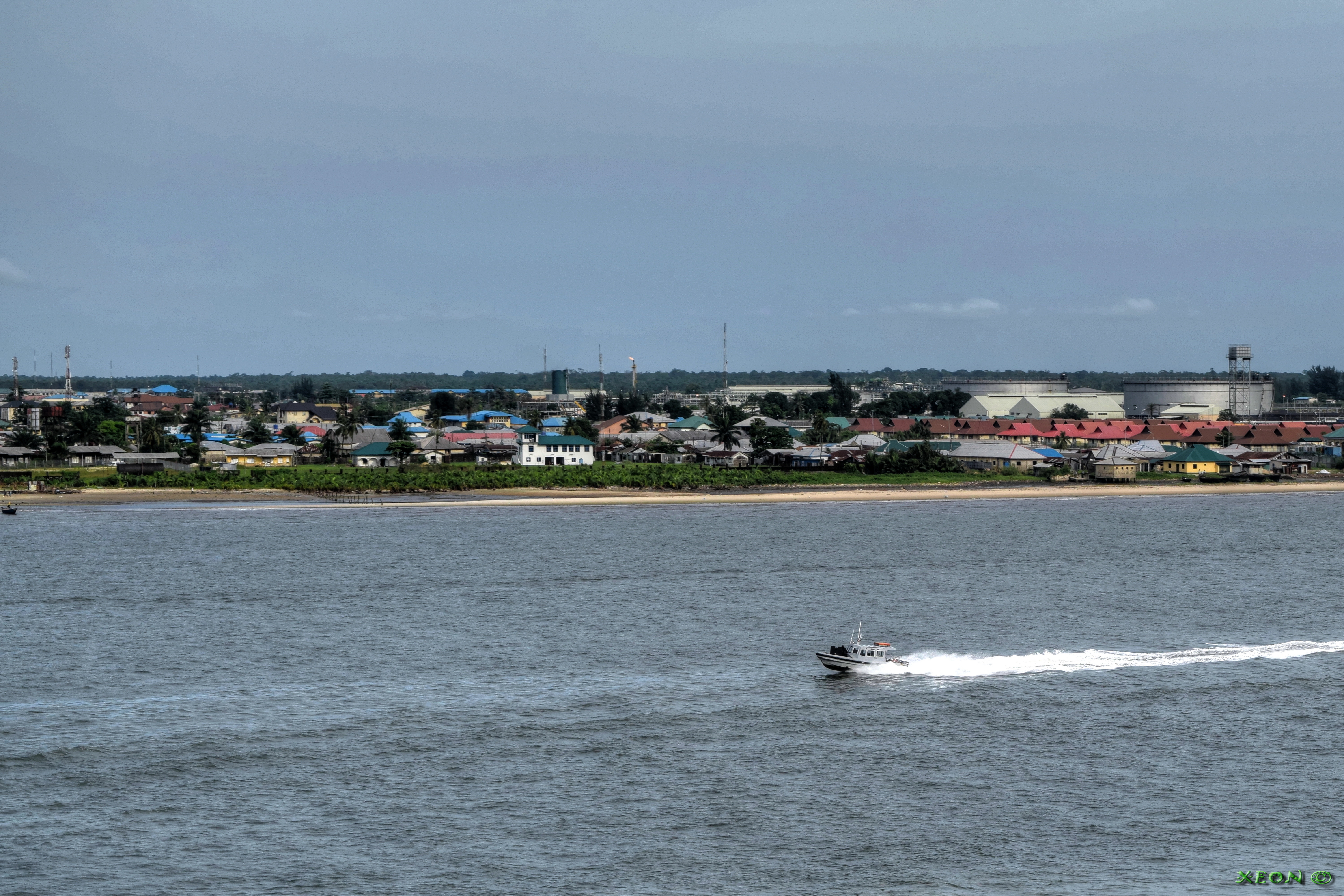
| Wa̱i a̱lyiat | Bonny City | ||
| A̱tuk | Taken on 23 Zwat Tswuon 2015 | ||
| A̱tyin | https://web.archive.org/web/20161102010623/http://www.panoramio.com/photo/124810607 | ||
| A̱tyulyuut | ---=XEON=--- | ||
| A̱wat (Á̱ bu shyia̱ di̱ nyia̱ ta̱m ma̱ng fail huni) |
Á̱ nwuak fail huni a̱tafa kwambwat a̱ka̱wat Creative Commons A̱di̱dam Kaswuo 3.0 Unported hu hwa.
|
||
| Panoramio Tags | Bonny, 2015, Bonny River - Nigeria, Buildings - Arhitecture - Construction - Architecture, Coast - Bank - Waterfront - Waterside - River Side - Ripe - Land - Earth - Ground - Spil - Terra, Rivers - Canals - Chanals - Water - Pond - Pool - Reservuar - Fountain, Seas - Oceans - Strait - Pass - Channel - Canal - Sea Roads - Oceans Roads - Fairways - Seaway - Clearway - Harbor - Haven - Port - Seaport - Bay - Cove - Creek, Ships - Vessel - Boat - Tug - Yacht - Barge - Barche - Oil Rig - Platforms, True Position By GPS - Correct Position - WGS84 - WGS 84 - World Geodetic System 1984 |
| Camera location | | View this and other nearby images on: OpenStreetMap |
|---|
Nkhang fail
Nyap a̱tuk/jen a nwuan fail hu ma̱nang ku ku ndi di̱ ntsa hu mi̱ di̱n jen a̱ja.
| A̱tuk/Jen | A̱gban ghwughwu | Shi-a̱ka̱ta̱m | A̱tyunta̱m | A̱di̱dam | |
|---|---|---|---|---|---|
| mi̱ di̱ yong huni | 15:19, 20 Zwat A̱taa 2017 | | 6,000 × 4,000 (6.28 MB) | Panoramio upload bot | == {{int:filedesc}} == {{Information |description=Bonny City |date={{Taken on|2015-05-23}} |source=http://www.panoramio.com/photo/124810607 |author=[http://www.panoramio.com/user/760796?with_photo_id=124810607 ---=XEON=---] |permission={{cc-by-3.0|---=... |
Nyian ta̱m ma̱ng fail
Wat huni nyia̱ ta̱m ma̱ng fail huni:
Nyian ta̱m ma̱ng fail mi̱ swanta hu a̱mgba̱m
A̱yaawuki á̱ghyang bani nyia̱ ta̱m ma̱ng fail huni:
- Nyian ta̱m di̱ bi.wikipedia.org
- Nyian ta̱m di̱ ca.wikipedia.org
- Nyian ta̱m di̱ ceb.wikipedia.org
- Nyian ta̱m di̱ en.wikipedia.org
- Nyian ta̱m di̱ es.wikipedia.org
- Nyian ta̱m di̱ fr.wikipedia.org
- Nyian ta̱m di̱ ha.wikipedia.org
- Nyian ta̱m di̱ ig.wikipedia.org
- Nyian ta̱m di̱ pl.wikipedia.org
- Nyian ta̱m di̱ pt.wikipedia.org
- Nyian ta̱m di̱ ru.wikipedia.org
- Nyian ta̱m di̱ uk.wikipedia.org
- Nyian ta̱m di̱ www.wikidata.org
- Nyian ta̱m di̱ yo.wikipedia.org
- Nyian ta̱m di̱ zu.wikipedia.org